

Jump to GB-0347 Isles of Scilly Details of Activation and Logbook.
This trip, from the mainland to the Isles of Scilly, served two purposes. The first was to sail on the RMV Scillonian III for the last time and to activate GB-0347 Parks on the Air Isles of Scilly AONB.
RMV Scillonian III
The RMV Scillonian III entered service forty-nine years ago in 1977. It has served the islands with great aplomb in that time, ferrying both islanders and visitors back and forth to Penzance. Some times the weather has been favourable, but other times the weather has been absolutely terrible.
She was built in Appledore, Devon, as a 1,265 ton passenger cargo vessel. She has a cargo hold forward and space to store half-sized containers on deck. Her designation as RMV indicates that she is an official Royal Mail Vessel carrying mail and parcels and is one of the last Royal Mail vessels still operating in the world – they used to be found all over the place at one time.
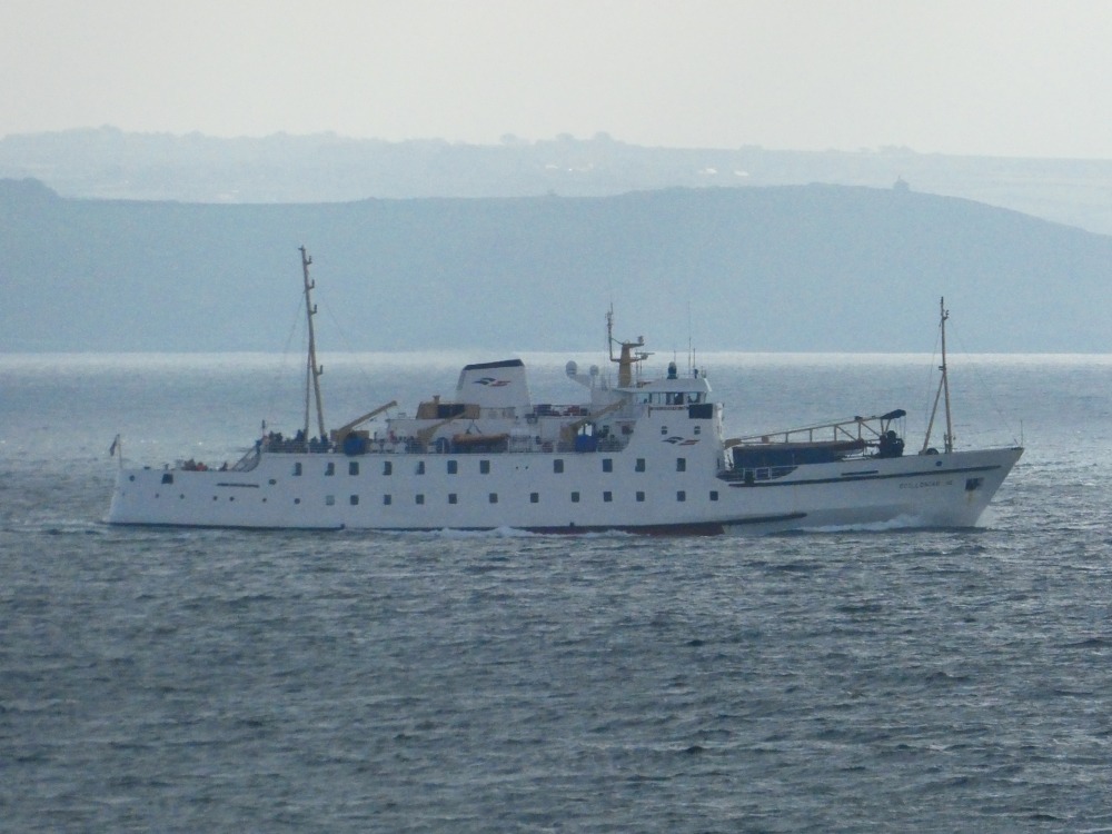
In favourable weather, which we enjoyed on our trip, the trip between Penzance and St. Mary (the largest in the Scilly archipelago) takes around two and three-quarter hours. She sails out with the stunning West Cornish coast on the starboard (right) side passing historic and evocative sites including Penlee Lifeboat Station, Mousehole, Tatter-Dhu lighthouse, the scene of the worst lifeboat disaster in Britain, Lamorna Cove, Porthcurno, the Minack Theatre, the Runnel Stone light bouy, and Lands End (the most westerly point in the British mainland. As she sails out into the Atlantic Ocean she then passes Wolf Rock Lighthouse on her port (left) side.
She completes the thirty-two mile trip by slipping into St. Mary’s. Originally operating twelve months a year, she now runs a service for eight months in the year (Mar – Oct) as a the demand is much lower during the winter months and there is also a cargo-only vessel running daily services.
We will, no doubt, have to make this trip again next year as the Scillonian IV will have entered service at the start of the 2027 cruising season.
The Isles of Scilly
The Isles of Scilly are an archipelago of 145 islands. They are located in the Atlantic Ocean, some 30-odd miles off the South West tip of Cornwall, itself the most westerly point of mainland Britain. Only five of the islands are inhabited; St. Mary’s, Tresco, St. Martin’s, Bryher and St. Agnes. The total population is around 2,300.
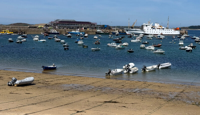

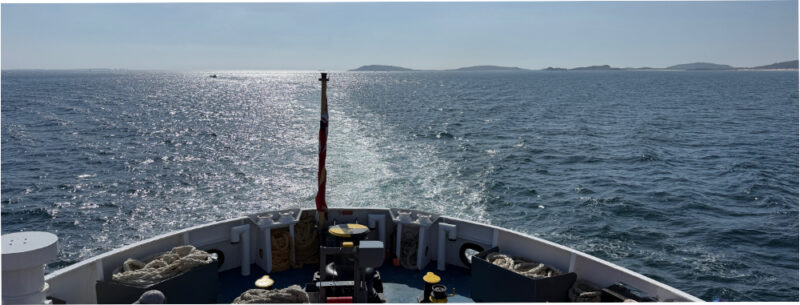
The islands enjoy a humid subtropical climate and, as a result, is the warmest place in the UK with an average annual temperature of 12 degrees C. The mild winters and cool summers make this an ideal location for growing flowers for export to the mainland.
Tourists flock to the islands every year to enjoy the climate, white sandy beaches and peaceful relaxed atmosphere. Whilst there are no particularly high points on the islands, the highest point is about 51M above sea level, the coastal views are stunning.
Details of my GB-0347 Activation
Callsign used
G7LFC
Date
11th August, 2026
Weather conditions
Sunny, around 20 Degrees C during the day, with a very light breeze.
Equipment used
Icom IC-705, mAT-705 Antenna Tuner, Totalcool GP09 38,000mAh/144Wh power station (discontinued), Icom LC-192 back pack, cheap Chinese 5.6M/18.3 FT QRP Antenna, Microsoft Surface Pro 7 tablet with Kagwerks tactical case.
Software used
HAMRS Pro logbook, WSJT-X 3.0.1 64-bit datamodes software, BktTimeSync for time synchronisation, Microsoft Windows 11 and HamDeck Grid Distance Calculator.
Bands, modes and power used
15m, 12m and 10m using 5w of FT8.
Station setup
The station was setup on a bench overlooking the harbour on St. Mary’s. The antenna was staked into the embankment behind the bench, no other support was used. The counterpoise wires were all laid in the same direction.
Notable contacts
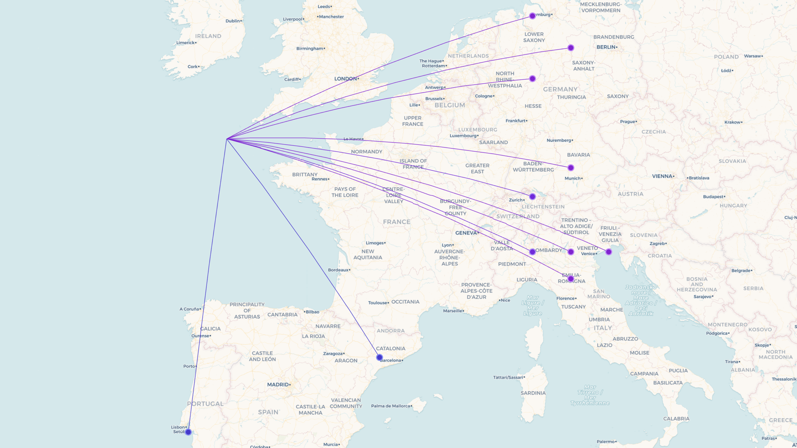
Probably, due to the poor arrangement of the counterpoise wires, all contacts were within Europe, the direction of the radials dictating where most contacts were to be had.
How did the activation of GB-0347 Isles of Scilly go?
This POTA activation almost didn’t go to plan for a couple of reasons.
Firstly, we arrived at the car park in Penzance, prior to boarding the Scillonian III, grabbed the back pack and thought it were a bit light. Upon further investigation I realised that I had left my laptop in the tent on charge from my previous activation of Wireless Point a couple of days previous. By some stroke of good fortune, I had decided to bring my Microsoft Surface Pro 7 down to Cornwall with me. I don’t know why as I never bring two computing devices with me. However, there it was in the van, so it was pressed into service. Save number 1.
At the end of the cruise out into the Atlantic Ocean aboard the Scillonian III we landed on the island of St. Mary’s. The weather was gorgeous, about 22 degrees C, and the wind slight. The sky was pretty much cloudless too – an absolutely idyllic day to be on the islands.
We carried our hand luggage ashore, which consisted of my radio station in my Icom rucksack and our food and Ali’s crafting in her backpack. A short gentle walk through the town and along the bay in which the Scillonian ties up in brought us to the St. Mary’s RNLI Lifeboat Station. This was a required stop as I have been collecting station mugs for several years now and am amassing quite a few, to the annoyance of my long-suffering wife.
Duly purchased we wandered a little further around the bay until we reached Porthmellon Beach. I originally started to set up in the small bank of sand dunes just off the beach. However, whilst assembling the equipment I realised that the ground wasn’t compacted enough for my 18’ telescopic antenna, which I’d already put up, to stay upright, even in the gentlest breeze that we were experiencing.

Fortunately, a bit further back off these dunes were some benches, behind which was a rising bank of more compacted earth. The base of the antenna went in relatively easy by hand and the antenna itself was much more stable. Save number 2.
This is the first time I’ve used this particular antenna, I have two. As a result I’d only split the eight strands of counterpoise ribbon wire into three at my previous activation of GB-0264 Wireless Point earlier in the week. With these situated higher up the embankment than the transceiver, I was getting RF into the station and I could not hold any contacts on 20, or 17m. Quite unlike the Wireless Point activation where the station was above the same counterpoise radials.
Fortunately, 15m, 12 and 10M were open and so I was able to make the ten required contacts on these bands. However, there weren’t lots of stations to be heard, so the contacts did take nearly an hour to complete.
As we only got three hours on the island before we needed to be back at the harbour to check in, we had used nearly two hours of it reaching the operating site and activating it – Ali’s hip does not allow us to walk at a normal pace unfortunately. So a gentle walk back through the town, a quick stop to eat my butties and a short queue to board the Scillonian III followed.
The trip back was as calm as the trip out. So the fact that I had left the Kwells in the car before we sailed from Penzance proved not to be an issue – I had taken one before the outward cruise, just as a precaution.
Pros and Cons
This was a short trip over to the Isles of Scilly with just a three hour turn around between landing and departing. Most of that time was spent walking to/from the activation point and operating. Unfortunately, it left little time to explore any more of the island than that. Next time, we will probably take an early Saturday sailing. Most days there is a single sailing, as on the day we went, but there are two sailings on a Saturday and, providing you get the first sailing over and the last back, you’ll get about seven hours on the island.
The other issue can be the weather. The islands are located in the Atlantic Ocean and the weather can be quite different to what Penzance is experiencing. So taking all weather gear is a really good idea. We didn’t bother on this trip as we were in the middle of a heatwave – we were lucky.
The other issue is the sea. Even on the smoothest day out of Penzance, once the ship approaches and sails past Lands End the waters can be choppy – and who knows what the seas will be like on the way back, things can change quickly. The Scillonian III is flat bottomed to get into both harbours on the trip, so she doesn’t react well to a bit of rough water. On our trip, we were very fortunate as the sea state was very favourable all the way in both directions. However, this hasn’t always been my experience so I always pop a Kwells about 45 minutes before departure – just in case.
Observations and lessons learned
The first thing to remember in future is to always check you have all the required equipment before you set off in the van. I was lucky, but this could have been a non-event radio wise.
Secondly, I need to have my radials lower than my station. I should also have done a bit more homework on where I was to operate from, though the required visit to the RNLI Lifeboat Station did kind of dictate the direction we left Hugh Town in. I’ll probably head out on to the headland overlooking the sea, by the Garrison, next time.
GB-0347 Map & Logbook
| Callsign | Date | Time | Band | Mode | RST Tx | RST Rx | Locator | Power |
|---|---|---|---|---|---|---|---|---|
| CR7BRV | 20260811 | 123400 | 15m | FT8 | +04 | -15 | IM58 | 5 |
| EA3ZD | 20260811 | 123715 | 15m | FT8 | +05 | -14 | JN01 | 5 |
| DD0AM | 20260811 | 124415 | 10m | FT8 | -05 | -14 | JO41 | 5 |
| IK4LZH | 20260811 | 124730 | 10m | FT8 | +01 | -19 | JN54 | 5 |
| DN9AD | 20260811 | 124830 | 10m | FT8 | -09 | -22 | JO52 | 5 |
| IK3BNO | 20260811 | 124930 | 10m | FT8 | +10 | -23 | JN65 | 5 |
| DN9TB | 20260811 | 125300 | 10m | FT8 | -03 | -14 | JO41 | 5 |
| IW2CAK | 20260811 | 130800 | 12m | FT8 | +02 | -18 | JN45 | 5 |
| HB9HRR | 20260811 | 130930 | 12m | FT8 | +03 | -11 | JN47 | 5 |
| DN9TTH | 20260811 | 131800 | 10m | FT8 | +09 | -19 | JN58 | 5 |
| IZ3EAW | 20260811 | 131930 | 10m | FT8 | +00 | -15 | JN55 | 5 |
| DN9WHV | 20260811 | 132230 | 10m | FT8 | +08 | -21 | JO43 | 5 |